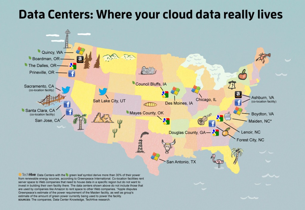
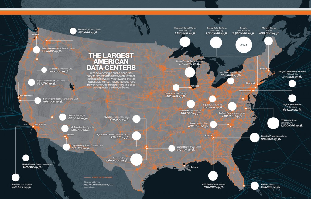
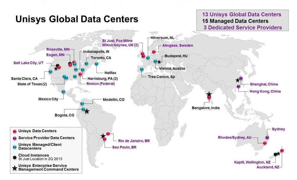
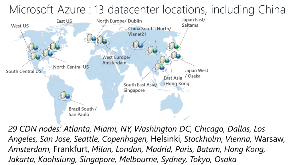
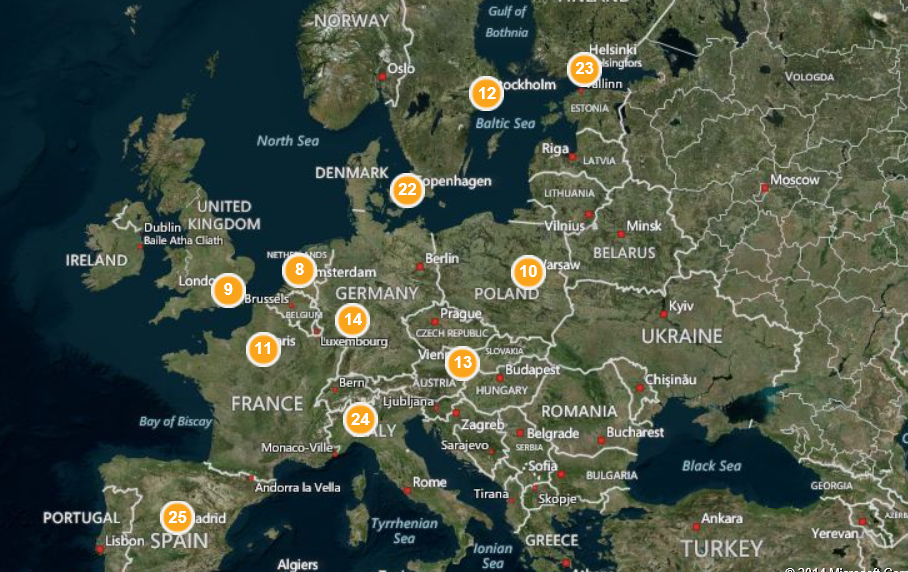
Although data centers are unevenly distributed, but it’s intriguing to observe the way they’re located spatially. It’s difficult to find world maps but here are some examples I found interesting, but it’s totally not exhaustive (lots of them are not documented). Also note that any queries on image search engine about data center geography leads to weather-related visualizations (which generally influence energy/water consumption for this infrastructure).
The largest US data-centers (by Nicolas Rapp, data by Dave Drazen at Geo-Tel)
Unisys Data Centers
Maps of Data Centers (Techive)
